

"Sand Dune Lake" is a sandy beach that forms undulations due to the wind.、These are freshwater swamps that are naturally formed when rivers flow into depressions (Sagata, Niigata Prefecture, etc.)。Underwater sand swells up like an embankment due to ocean currents and waves, blocking the exit.、(It is formed differently from brackish water lakes such as Lake Saroma and Hachirogata)。The dune lake itself is a valuable entity that is being lost worldwide.、Creating a biologically valuable environment。
Sand dune lake is a natural freshwater pond in a sandhill. It was shaped by wind. The wind had been carring sand and formed ups and downs, and then water stream into hollow places. It is not only very valuable existence itself in the world but also it gives important environment for biodeversity that’s being lost.
In Higashidori Village、There are many large and small "sand dune lakes" (13 named swamps alone)。Higashidori Village, Sarugamori Sand Dunes, and Back Wetlands have been selected as one of Japan's 500 important wetlands (in fact, it can be said that most of the Shimokita Peninsula has been selected in this way).。This monkey ga forest sand dune (width 1-2 km)、"Shimokita Sand Dunes" is a combination of sand dunes (total length 17 km) and sand dunes that go slightly inland.、Although it is little known, it is actually the largest sand dune in Japan.。The reason it's not known is、Wind and sand protection forests surround the sand dunes.、Things that are difficult for people to see、Most of it is used by the Ministry of Defense and others for ballistic test sites, etc.、This is because entry is prohibited.。
There are many dune lakes in Higashi-dori village. Named lakes are minimum 13s. Salugamori sandhill (1~2 km width, 17 km length) include the rear wetland in this village has selected one of 500 of the important wetland of Japan (Actually most of Shimokita peninsula is selected also). Additionaly, Shimokita sandhill (includ this Salugamori sandhill with the next ones) is really the biggest one in Japan. However almost all japanese don’t know of it. One of the reason is that this place is hidden from the roads by pine grove for protect the wind and the sand. The other one, here is off limited, because this ares has been useing for test site of trajectory of Ministry of Defence (MD).
The dune lake itself is outside the Ministry of Defense area.、Some of them seem to be used for fishing purposes as well.。However, the pine forests used for wind and sand protection have also grown larger.、Many of the roads leading to the swamp are disappearing.。Population decline and aging continue here as well.、No academic research is currently being conducted.。
These are out of the area of MD. A few lakes of it look as useing fishery sometimes but not often. Most of the roads to go there is being lost by growing thickly weeds and pine grove. Creasing depopulation and ageing there. Academic reserch stopped now.
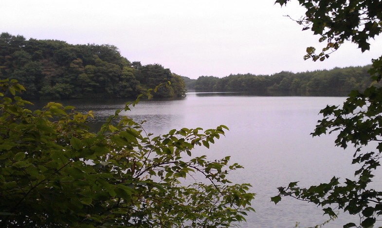
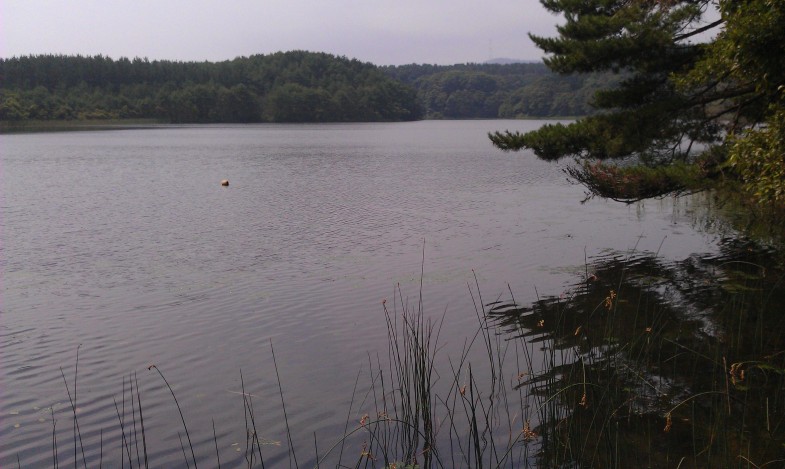
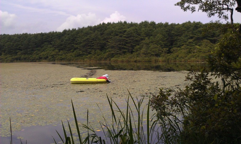
Photos are from top to bottom (arranged from north to south)、Onuma、Sakyo Marsh、Aranuma。The size and depth vary slightly, but they are all in their natural state.。Onuma is a big shrimp、Sakyo-numa is famous for Aegagropila Linnaei.、What happens now that no research has been done?。Aranuma is 1-2m deep.、Brasenia schreberi is being harvested.。
Photo:(above) O-numa. Small river prawn lives in. (midlle) Sakyo-numa. Sakyo-numa is famous for “Hime-malimo” (small moss ball), but how is it now? (bottom) An old woman was picking “Jun-sai” (the water shield) from the water at lake Ala-numa. ※numa means lake or pond. All of dune lakes are Nature.