ทะเลสาบเนินทรายเป็นหาดทรายที่ก่อตัวเป็นลูกคลื่นเนื่องจากลม、เหล่านี้เป็นหนองน้ำจืดที่เกิดขึ้นตามธรรมชาติเมื่อแม่น้ำไหลลงสู่ที่ลุ่ม (ซากาตะ จังหวัดนีงะตะ ฯลฯ)。ทรายใต้น้ำพองตัวเหมือนเขื่อนเนื่องจากกระแสน้ำและคลื่นในมหาสมุทร ปิดกั้นทางออก、(ก่อตัวแตกต่างจากทะเลสาบน้ำกร่อย เช่น ทะเลสาบซาโรมะ และฮาชิโรงาตะ)。ทะเลสาบเนินทรายเป็นสิ่งล้ำค่าที่กำลังสูญหายไปทั่วโลก、การสร้างสภาพแวดล้อมที่มีคุณค่าทางชีวภาพ。
Sand dune lake is a natural freshwater pond in a sandhill. It was shaped by wind. The wind had been carring sand and formed ups and downs, and then water stream into hollow places. It is not only very valuable existence itself in the world but also it gives important environment for biodeversity that’s being lost.
ในหมู่บ้านฮิกาชิโดริ、มี "ทะเลสาบเนินทราย" ขนาดใหญ่และขนาดเล็กจำนวนมาก (เพียง 13 แห่งที่ชื่อว่าหนองน้ำ)。หมู่บ้านฮิกาชิโดริ เนินทรายซารุกาโมริ และพื้นที่ชุ่มน้ำด้านหลังได้รับเลือกให้เป็นหนึ่งใน 500 พื้นที่ชุ่มน้ำที่สำคัญของญี่ปุ่น (อันที่จริงอาจกล่าวได้ว่าคาบสมุทรชิโมคิตะส่วนใหญ่ได้รับเลือกด้วยวิธีนี้)。เนินทรายป่าลิงกาแห่งนี้ (กว้าง 1-2 กม.)、"เนินทรายชิโมคิตะ" เป็นการผสมผสานระหว่างเนินทราย (ความยาวรวม 17 กม.) และเนินทรายที่เคลื่อนตัวเข้าไปด้านในเล็กน้อย、แม้จะไม่ค่อยมีใครรู้จัก แต่จริงๆ แล้วที่นี่เป็นเนินทรายที่ใหญ่ที่สุดในญี่ปุ่น。สาเหตุที่ไม่ทราบก็คือ、ป่าป้องกันลมและทรายล้อมรอบเนินทราย、สิ่งที่ยากที่คนจะมองเห็น、ส่วนใหญ่ถูกใช้โดยกระทรวงกลาโหมและหน่วยงานอื่นๆ สำหรับสถานที่ทดสอบขีปนาวุธ ฯลฯ、เนื่องจากห้ามเข้า。
There are many dune lakes in Higashi-dori village. Named lakes are minimum 13s. Salugamori sandhill (1~2 km width, 17 km length) include the rear wetland in this village has selected one of 500 of the important wetland of Japan (Actually most of Shimokita peninsula is selected also). Additionaly, Shimokita sandhill (includ this Salugamori sandhill with the next ones) is really the biggest one in Japan. However almost all japanese don’t know of it. One of the reason is that this place is hidden from the roads by pine grove for protect the wind and the sand. The other one, here is off limited, because this ares has been useing for test site of trajectory of Ministry of Defence (MD).
ทะเลสาบเนินทรายนั้นอยู่นอกพื้นที่กระทรวงกลาโหม、บางส่วนดูเหมือนว่าจะใช้เพื่อการตกปลาเช่นกัน。อย่างไรก็ตามป่าสนที่ใช้ป้องกันลมและทรายก็มีขนาดใหญ่ขึ้นเช่นกัน、ถนนหลายสายที่นำไปสู่หนองน้ำหายไป。การลดลงของประชากรและการสูงวัยยังคงดำเนินต่อไปที่นี่เช่นกัน、ขณะนี้ไม่มีการวิจัยทางวิชาการอยู่ระหว่างดำเนินการ。
These are out of the area of MD. A few lakes of it look as useing fishery sometimes but not often. Most of the roads to go there is being lost by growing thickly weeds and pine grove. Creasing depopulation and ageing there. Academic reserch stopped now.
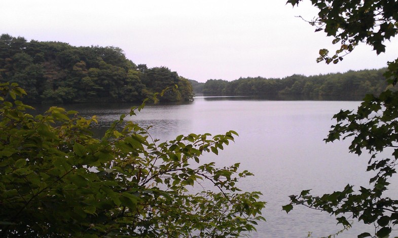
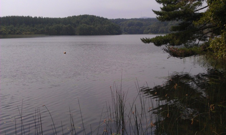
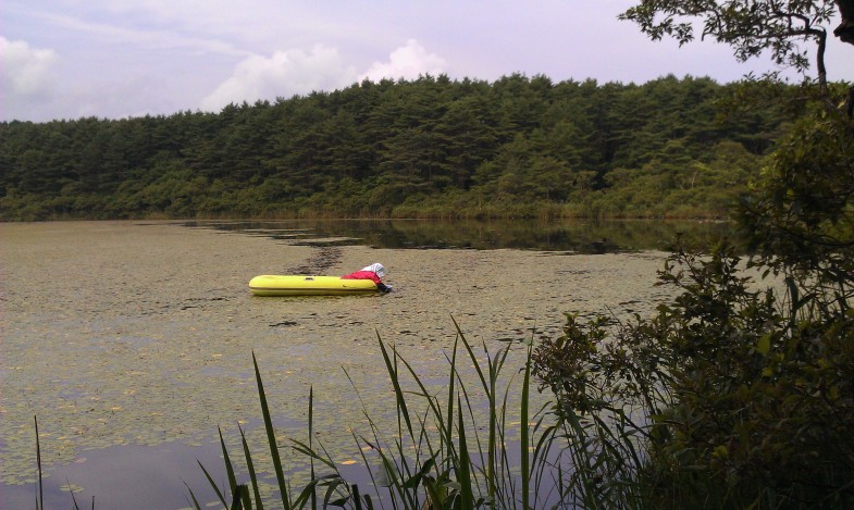
ภาพถ่ายเรียงจากบนลงล่าง (เรียงจากเหนือลงใต้)、โอนุมะ、บึงซาเคียว、อรานุมะ。ขนาดและความลึกจะแตกต่างกันเล็กน้อย แต่ทั้งหมดก็อยู่ในสภาพธรรมชาติ。โอนุมะเป็นกุ้งตัวใหญ่、Sakyo-numa มีชื่อเสียงในเรื่อง Aegagropila Linnaei、จะเกิดอะไรขึ้นหากไม่มีการวิจัย?。Aranuma มีความลึก 1-2 เมตร、กำลังเก็บเกี่ยว Brasenia schreberi。
Photo:(above) O-numa. Small river prawn lives in. (midlle) Sakyo-numa. Sakyo-numa is famous for “Hime-malimo” (small moss ball), but how is it now? (bottom) An old woman was picking “Jun-sai” (the water shield) from the water at lake Ala-numa. ※numa means lake or pond. All of dune lakes are Nature.
