

«Ավազ Դյուն լիճ» նշանակում է, որ ավազոտ լողափերը քամու եւ այլ գործոնների պատճառով բուռն են ստեղծում:、Այն քաղցրահամ ջրերի ճահիճ է, որը, բնականաբար, ձեւավորվել է գետերի կողմից ընկած գետերի կողմից (օրինակ, Սագատա, Նիիգատա պրեֆեկտուրա):。Օվկիանոսի հոսանքներն ու ալիքները ավազի պես կբարձրանան բանկի պես եւ արգելափակել ելքը、Այն տարբերվում է նաեւ Brackish Lakes- ից, ինչպիսիք են Սարոմա լիճը եւ Հաճիրոգաթան :)。Ավազի դյուն լիճն ինքնին արժեքավոր է, որ կորչում է ամբողջ աշխարհում:、Այն ստեղծում է կենսաբանորեն արժեքավոր միջավայր。
Sand dune lake is a natural freshwater pond in a sandhill. It was shaped by wind. The wind had been carring sand and formed ups and downs, and then water stream into hollow places. It is not only very valuable existence itself in the world but also it gives important environment for biodeversity that’s being lost.
Հիգաշիդորի գյուղում、Կան շատ մեծ եւ փոքր «Dune Lakes» (միայն ճահիճների 13 անուն կա)。Հիգաշիդորի գյուղը, կապիկ անտառային ավազի ջրամբարները եւ հետախուզական խոնավ վայրերը ընտրվել են որպես of ապոնիայի 500 կարեւոր խոնավ վայրերից մեկը (կարելի է ասել, որ Շիմոկիտա թերակղզու մեծ մասը ստացել է այս ընտրությունը):。Այս կապիկը անտառային ավազի դյուն է (1-2 կմ լայնություն)、Shimokita ավազի ջրամբարները, որոնք համատեղում են 17 կմ-ի ընդհանուր երկարությունը) եւ ավազի գետերը, որոնք մտել են մի փոքր ներքին տարածք, կան、Հազվադեպ է հայտնի, բայց դա իրականում Japan ապոնիայի ամենամեծ ավազի դյունն է:。Պատճառը անհայտ է、Երկկողմանի եւ ավազի դիմացկուն անտառները շրջապատում են ավազի գետերը:、Մարդկանց համար դժվար է տեսնել、Պաշտպանության նախարարության եւ այլոց մեծ մասը այն օգտագործում են բալիստիկ փորձարկման վայրերում:、Քանի որ մուտքն արգելվում է。
There are many dune lakes in Higashi-dori village. Named lakes are minimum 13s. Salugamori sandhill (1~2 km width, 17 km length) include the rear wetland in this village has selected one of 500 of the important wetland of Japan (Actually most of Shimokita peninsula is selected also). Additionaly, Shimokita sandhill (includ this Salugamori sandhill with the next ones) is really the biggest one in Japan. However almost all japanese don’t know of it. One of the reason is that this place is hidden from the roads by pine grove for protect the wind and the sand. The other one, here is off limited, because this ares has been useing for test site of trajectory of Ministry of Defence (MD).
Դուն Լիճը գտնվում է Պաշտպանության նախարարությունից դուրս:、Ոմանք, կարծես, օգտագործվում են ձկնորսության համար:。Այնուամենայնիվ, հողմակայուն եւ ավազի ապացույց սոճու անտառներն ավելի մեծ են աճել、Ճահճի տանող ճանապարհներից շատերը սկսում են անհետանալ。Բնակչության անկումը եւ ծերացումը նույնպես առաջ են ընթանում、Այժմ որեւէ ակադեմիական հետազոտություն չի իրականացվում:。
These are out of the area of MD. A few lakes of it look as useing fishery sometimes but not often. Most of the roads to go there is being lost by growing thickly weeds and pine grove. Creasing depopulation and ageing there. Academic reserch stopped now.
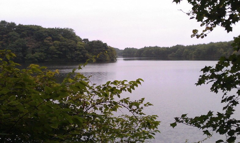
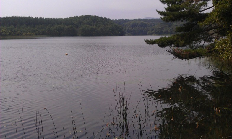
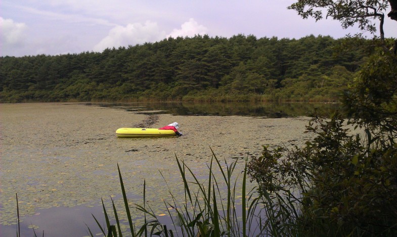
Լուսանկարը վերեւից է (կնճռոտ հյուսիսից հարավ)、Onuma、Sakyonuma、Aranuma。Չափերը և խորությունը փոքր-ինչ տարբերվում են, բայց դրանք բոլորն էլ իրենց բնական վիճակում են:。Օնուման մեծ ծովախեցգետին է、Sakyo-numa-ն հայտնի է Aegagropila Linnaei-ով։、Ի՞նչ է տեղի ունենում հիմա, երբ ոչ մի հետազոտություն չի արվել:。Արանուման 1-2 մ խորություն ունի։、Brasenia schreberi-ն հավաքվում է։。
Photo:(above) O-numa. Small river prawn lives in. (midlle) Sakyo-numa. Sakyo-numa is famous for “Hime-malimo” (small moss ball), but how is it now? (bottom) An old woman was picking “Jun-sai” (the water shield) from the water at lake Ala-numa. ※numa means lake or pond. All of dune lakes are Nature.