மணல் மேடு ஏரி என்பது மணல் நிறைந்த கடற்கரையாகும், இது காற்றின் காரணமாக அலைகளை உருவாக்குகிறது.、இவை நன்னீர் சதுப்பு நிலங்களாகும்。கடல் நீரோட்டங்கள் மற்றும் அலைகள் காரணமாக நீருக்கடியில் மணல் ஒரு கரை போல் வீங்கி வெளியேறுவதைத் தடுக்கிறது.、சரோமா ஏரி மற்றும் ஹச்சிரோகட்டா போன்ற உவர் நீர் ஏரிகளிலிருந்தும் உருவாக்கம் வேறுபட்டது)。மணல் மேடு ஏரி என்பது உலகளவில் இழக்கப்படும் ஒரு மதிப்புமிக்க நிறுவனமாகும்.、உயிரியல் மதிப்புமிக்க சூழலை உருவாக்குதல்。
Sand dune lake is a natural freshwater pond in a sandhill. It was shaped by wind. The wind had been carring sand and formed ups and downs, and then water stream into hollow places. It is not only very valuable existence itself in the world but also it gives important environment for biodeversity that’s being lost.
ஹிகாஷிடோரி கிராமத்தில்、பல பெரிய மற்றும் சிறிய "மணல் குன்று ஏரிகள்" உள்ளன (13 சதுப்பு நிலங்கள் மட்டும்).。ஜப்பானின் 500 முக்கியமான ஈரநிலங்களில் ஒன்றாக ஹிகாஷிடோரி கிராமம், சருகமோரி மணல் திட்டுகள் மற்றும் பின் ஈரநிலங்கள் தேர்ந்தெடுக்கப்பட்டுள்ளன (உண்மையில், ஷிமோகிடா தீபகற்பத்தின் பெரும்பாலான பகுதிகள் இவ்வாறு தேர்ந்தெடுக்கப்பட்டுள்ளன என்று கூறலாம்).。இந்த குரங்கு கா வன மணல் மேடு (அகலம் 1-2 கிமீ)、"ஷிமோகிதா மணல் குன்றுகள்" என்பது மணல் திட்டுகள் (மொத்த நீளம் 17 கிமீ) மற்றும் சற்று உள்நாட்டிற்கு செல்லும் மணல் திட்டுகளின் கலவையாகும்.、இது அதிகம் அறியப்படவில்லை என்றாலும், உண்மையில் இது ஜப்பானின் மிகப்பெரிய மணல் திட்டு ஆகும்.。அது தெரியவில்லை காரணம்、காற்று மற்றும் மணல் பாதுகாப்பு காடுகள் மணல் திட்டுகளை சூழ்ந்துள்ளன.、மக்கள் பார்க்க கடினமாக இருக்கும் விஷயங்கள்、இதில் பெரும்பாலானவை பாதுகாப்பு அமைச்சகம் மற்றும் பிறரால் பாலிஸ்டிக் சோதனை வரம்பாகப் பயன்படுத்தப்படுகின்றன.、நுழைவது தடைசெய்யப்பட்டதே இதற்குக் காரணம்.。
There are many dune lakes in Higashi-dori village. Named lakes are minimum 13s. Salugamori sandhill (1~2 km width, 17 km length) include the rear wetland in this village has selected one of 500 of the important wetland of Japan (Actually most of Shimokita peninsula is selected also). Additionaly, Shimokita sandhill (includ this Salugamori sandhill with the next ones) is really the biggest one in Japan. However almost all japanese don’t know of it. One of the reason is that this place is hidden from the roads by pine grove for protect the wind and the sand. The other one, here is off limited, because this ares has been useing for test site of trajectory of Ministry of Defence (MD).
டூன் ஏரி பாதுகாப்பு அமைச்சக பகுதிக்கு வெளியே உள்ளது.、அவற்றில் சில மீன்பிடி நோக்கங்களுக்காகவும் பயன்படுத்தப்படுகின்றன.。இருப்பினும், காற்று மற்றும் மணல் பாதுகாப்பிற்காக பயன்படுத்தப்படும் பைன் காடுகளும் பெரிதாக வளர்ந்துள்ளன.、சதுப்பு நிலத்திற்கு செல்லும் பல சாலைகள் மறைந்து வருகின்றன.。மக்கள்தொகை குறைவு மற்றும் முதுமை இங்கும் தொடர்கிறது.、தற்போது கல்வி சார்ந்த ஆய்வுகள் எதுவும் நடைபெறவில்லை.。
These are out of the area of MD. A few lakes of it look as useing fishery sometimes but not often. Most of the roads to go there is being lost by growing thickly weeds and pine grove. Creasing depopulation and ageing there. Academic reserch stopped now.
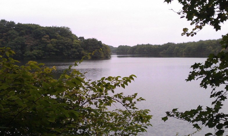
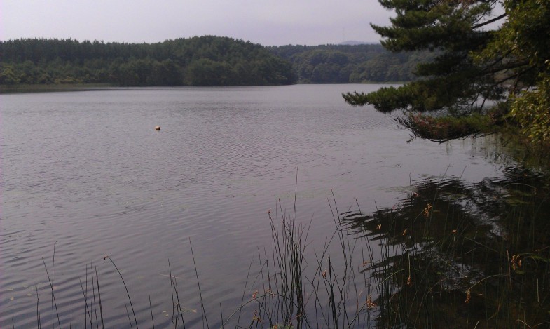
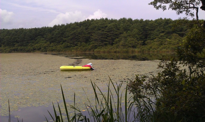
புகைப்படங்கள் மேலிருந்து கீழாக (வடக்கிலிருந்து தெற்காக வரிசைப்படுத்தப்பட்டுள்ளன)、ஒனுமா、சாக்யோ மார்ஷ்、அரனுமா。அளவு மற்றும் ஆழம் சற்று மாறுபடும், ஆனால் அவை அனைத்தும் அவற்றின் இயல்பான நிலையில் உள்ளன.。ஒனுமா ஒரு பெரிய இறால்、சக்யோ-நுமா ஏகாக்ரோபிலா லின்னேயிக்கு பிரபலமானது.、எந்த ஆராய்ச்சியும் செய்யப்படாத நிலையில் இப்போது என்ன நடக்கிறது?。அரனுமா 1-2மீ ஆழமானது.、பிரசேனியா ஸ்க்ரெபெரி அறுவடை செய்யப்படுகிறது.。
Photo:(above) O-numa. Small river prawn lives in. (midlle) Sakyo-numa. Sakyo-numa is famous for “Hime-malimo” (small moss ball), but how is it now? (bottom) An old woman was picking “Jun-sai” (the water shield) from the water at lake Ala-numa. ※numa means lake or pond. All of dune lakes are Nature.
